
Map design demonstration · Public platform example
Classical Garden Map · Building illustrations
A garden overview built around ponds, winding paths and pavilions, with freestanding building artwork and green landmark labels in a compact visitor space.
Building illustrations · Simplified Chinese
Reviewed:
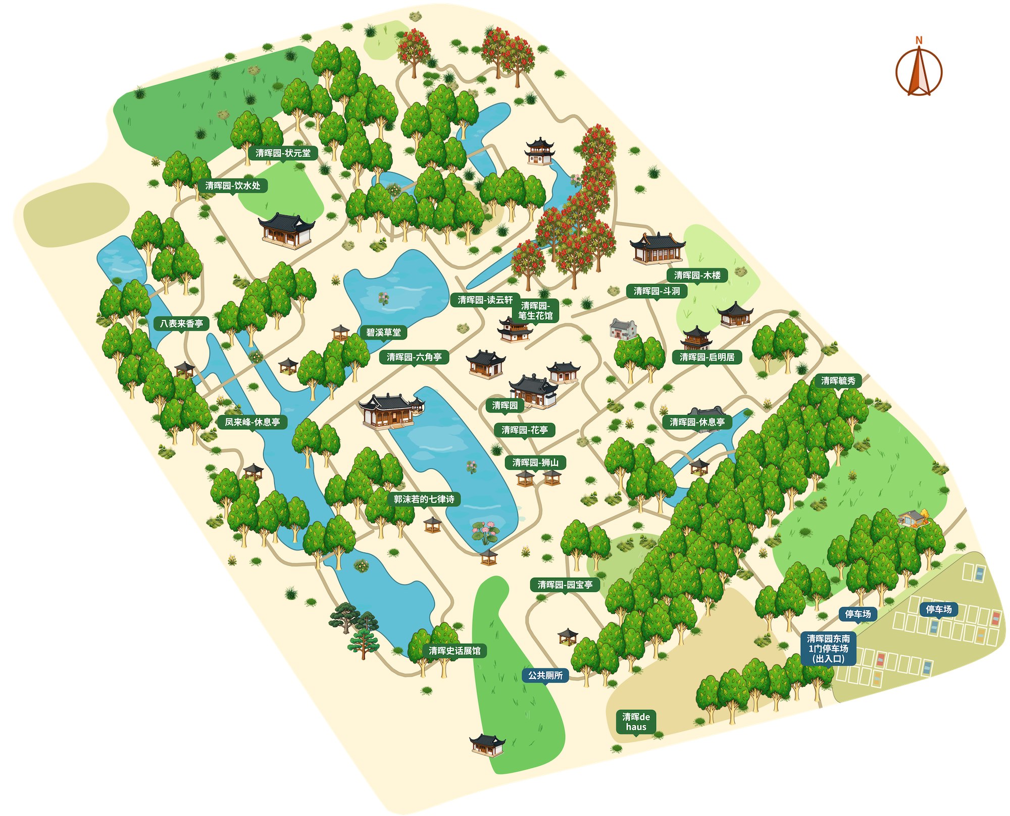
This page presents the complete artwork of an existing public platform example and describes its visible design. When creating a similar map, verify paths, names, entrances and access information. Building artwork sizes do not represent surveyed scale.
What does this example show?
- Interwoven ponds and paths retain the garden's turns and connections.
- Freestanding pavilions and halls are framed by layers of greenery.
- Green landmark labels and blue service labels distinguish different visitor needs.
How it was made & the artwork file
This page documents an existing public platform example, retaining its building artwork, greenery, paths, water and labels. The web preview is separately encoded as WebP; the original image can be opened directly.
The full artwork is a PNG image measuring 2000 × 1617 pixels. “Use this example” in the case library applies styling and assets to an existing project; the complete image itself is not an editable source project.
The editor offers SVG, PNG and PDF exports under plan entitlements. This page links to the existing demonstration artwork. A preview image is not an editable project and does not automatically include every export format.
View plans & export entitlementsCreate a similar map
1. Select an area and review the base map
Create a map, search for a place and select an area. Review paths, water, bridges and entrances in the base map, adding missing content from verified site information. Initial map creation does not automatically run AI arrangement.
2. Choose building and label treatments
Choose building illustrations and add artwork for selected landmarks. Check ground anchors, neighboring paths and entrances; decorative artwork sizes do not establish building scale.
3. Save and inspect the export
Save the editable project and choose an export format available under the current plan. At the final display size, check names, orientation, legends, entrances and attribution before preparing print or online use.
Sources & scope
The link below points to the already published original artwork. This page preserves its appearance and labels without adding an attraction endorsement or presenting it as surveyed navigation data. Before further publication, verify base-map sources, attribution and required permissions.