
YunMap · Illustrated Map Creation Guide
Smart guide connects maps, attractions and sightseeing routes
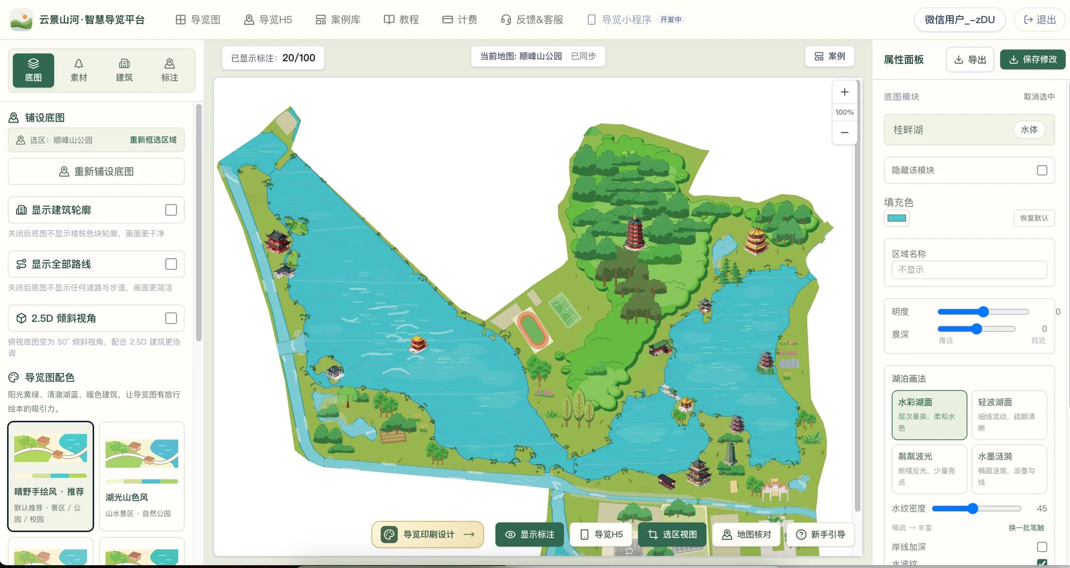
Visitors need more than just a beautiful map — they need to know where to enter, where to go next, and where the nearest public restroom is. Smart guides organize the map and this information together, creating a complete tour experience that combines on-site guidance and mobile viewing.
What problems should a smart guide system solve?
Entrances, attractions, parking lots, service centers and rest spots in the scenic area need to be organized uniformly. Label these locations by category so visitors can quickly locate the services they need; recommended routes help connect main sightseeing points, and announcements supplement temporary opening arrangements. Guide content should be synchronized with actual operations — closed entrances, adjusted routes and changed service hours must be verified and updated promptly.
AI smart guide first helps operators build quality content
Hand-drawn style maps are rendered by the system, and YunMap's AI capabilities are used for auxiliary production such as buildings and materials to reduce repetitive work in content creation. Visitors view scenic spots, categories, routes, and announcements via the digital guide. AI-assisted production does not automatically guarantee geographic accuracy, nor does it mean AI Q&A or audio narration is available on every guide page; operators must still review locations and introductions before going live.
Scenic areas, parks and campuses have different key information priorities
For scenic areas, you can prioritize organizing attractions, entrances/exits and tour routes; parks are more suitable for highlighting public restrooms, rest spots and parking lots; campuses can organize content around teaching buildings, administrative services and visitor entrances. First choose a clear visitor task, such as finding the service center from the entrance, then check whether the map, annotation categories and routes can work together to complete this task.
When choosing a smart guide SaaS platform, pay attention to post-maintenance support
Smart guide is not a one-time launch project. When using a SaaS platform, you can continuously edit content through a browser without remaking the entire map every time information changes. During evaluation, confirm whether map editing, Digital Guide H5 publishing, print delivery and package quotas meet your needs. It is recommended to experience the full workflow with a real area first, then decide on the production scale and operation arrangement.
Four steps from preparation to delivery
- 01
Organize Visitor Requirements
Identify entrances, main attractions and service facilities, and collect accurate names, locations, introductions and on-site photos.
- 02
Create Illustrated Maps
Choose an appropriate hand-drawn style, clarify the relationships between roads, water areas, buildings, and green spaces, and avoid decorations blocking navigation.
- 03
Organize visitor-side information
Organize markers by category, supplement attraction introductions, recommended routes and announcements to provide a clear information access entry.
- 04
On-site verification and continuous maintenance
After publishing, scan the QR code with your phone to test, walk through key routes from a visitor's perspective, then assign the person in charge of content updates.
FAQ
What is the difference between smart guide and hand-drawn maps?
Hand-drawn maps are responsible for presenting spatial layout and visual style; smart guides also organize sustainably updatable information such as scenic spot introductions, service categories, routes and announcements. You can first complete the map, then publish it as a Digital Guide H5 for visitors to view by scanning a QR code.
Is it necessary to develop a mini program for smart guide?
Not required. The Digital Guide H5 can be opened in a mobile browser via a link or QR code. The platform's Digital Guide H5 is already live, while the guide mini-program is still in development. You can use the H5 for digital guidance for now.
What do I need to prepare before starting production?
It is recommended to prepare the area scope, list of attractions, locations of entrances and service facilities, introduction text, on-site images, and route arrangements. The clearer the materials, the more convenient subsequent verification and updates will be.
Production and publishing benefits are subject toActivate Membershippage shall prevail. The free version exports with watermarks; 4K HD / 8K Ultra HD are paid features. Please verify the map and on-site information before official launch.
Create · Publish · Continuous Update
Find the guide creation method that suits you
A good hand-drawn map should be both appealing and easy to navigate. YunMap integrates real geographic areas, hand-drawn style base maps, building materials, and attraction annotations into a single online editing workflow, ideal for scenic spots, parks, campuses, and industrial parks to create their own Illustrated Maps.
Smart Guide PlatformVisitors need more than just a beautiful map — they need to know where to enter, where to go next, and where the nearest public restroom is. Smart guides organize the map and this information together, creating a complete tour experience that combines on-site guidance and mobile viewing.
Digital Guide H5Place the QR code at entrances, brochures, or service desks — visitors can open the guide map with their mobile phones. Digital Guide H5 is suitable for scenarios where visitors need to quickly view scenic spots and facilities, and it is also convenient for operators to maintain content after scenic spot information changes.