
Smart Guide Platform
Illustrated Maps×Digital Guides
Create illustrated maps for attractions, parks and campuses using real geographic data. Edit your map, prepare print layouts and export in high resolution. English Digital Guide H5 is coming soon.

First see how tourists use it
Scan the WeChat QR code to experience the classical garden guide
Click the QR code to enlarge and view
Free trial for new users · 10 vector base map uses per month · No download or installation required
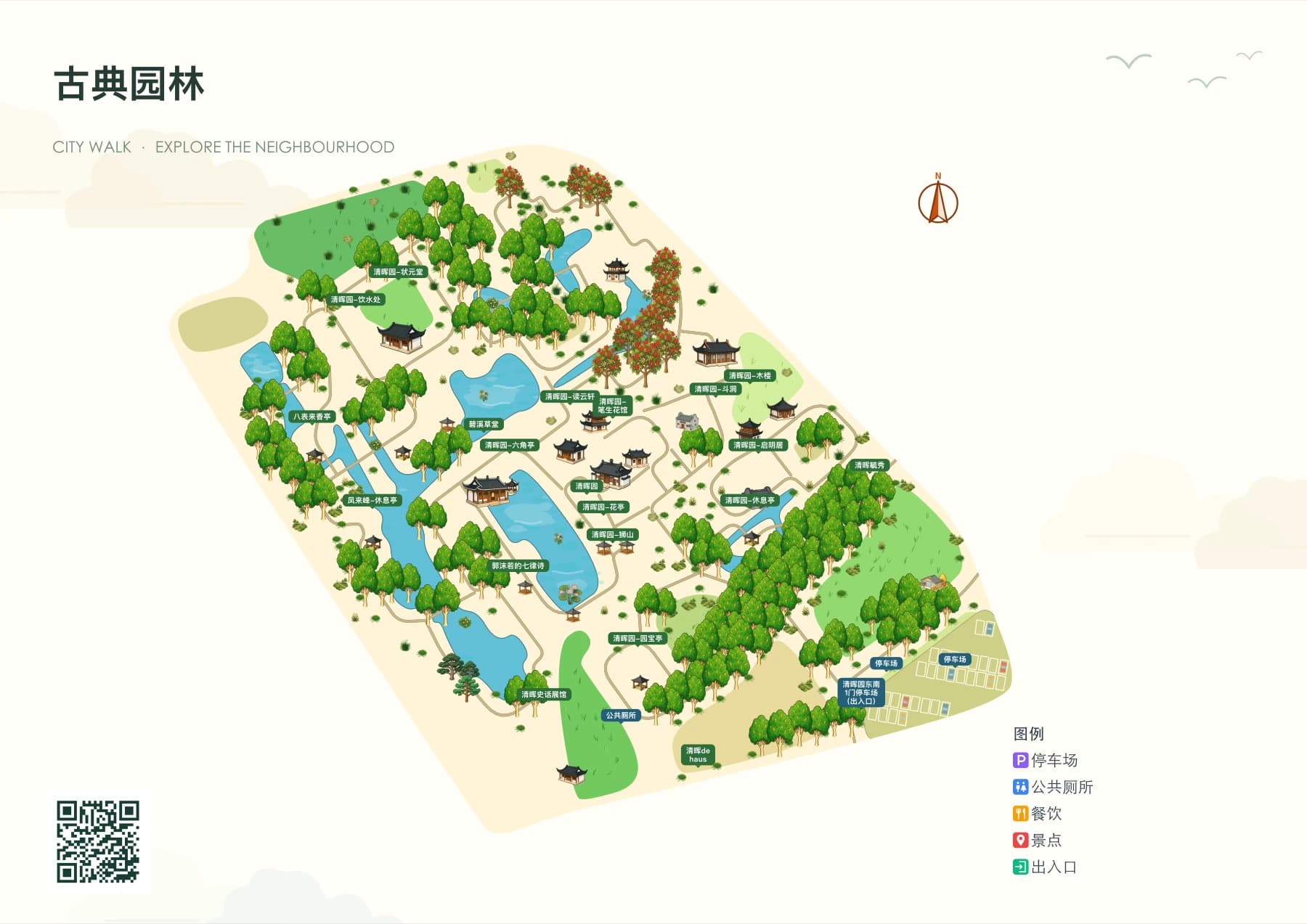
Visitor Mobile End
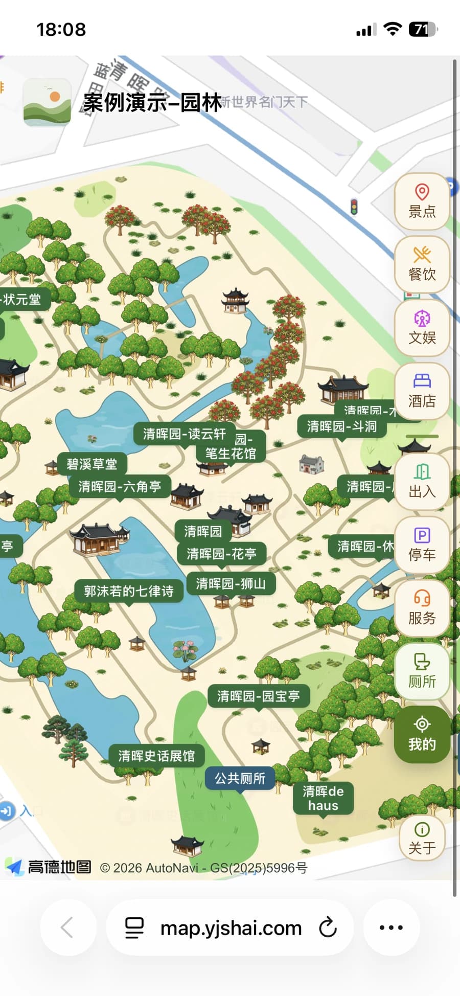
H5 Digital Guide
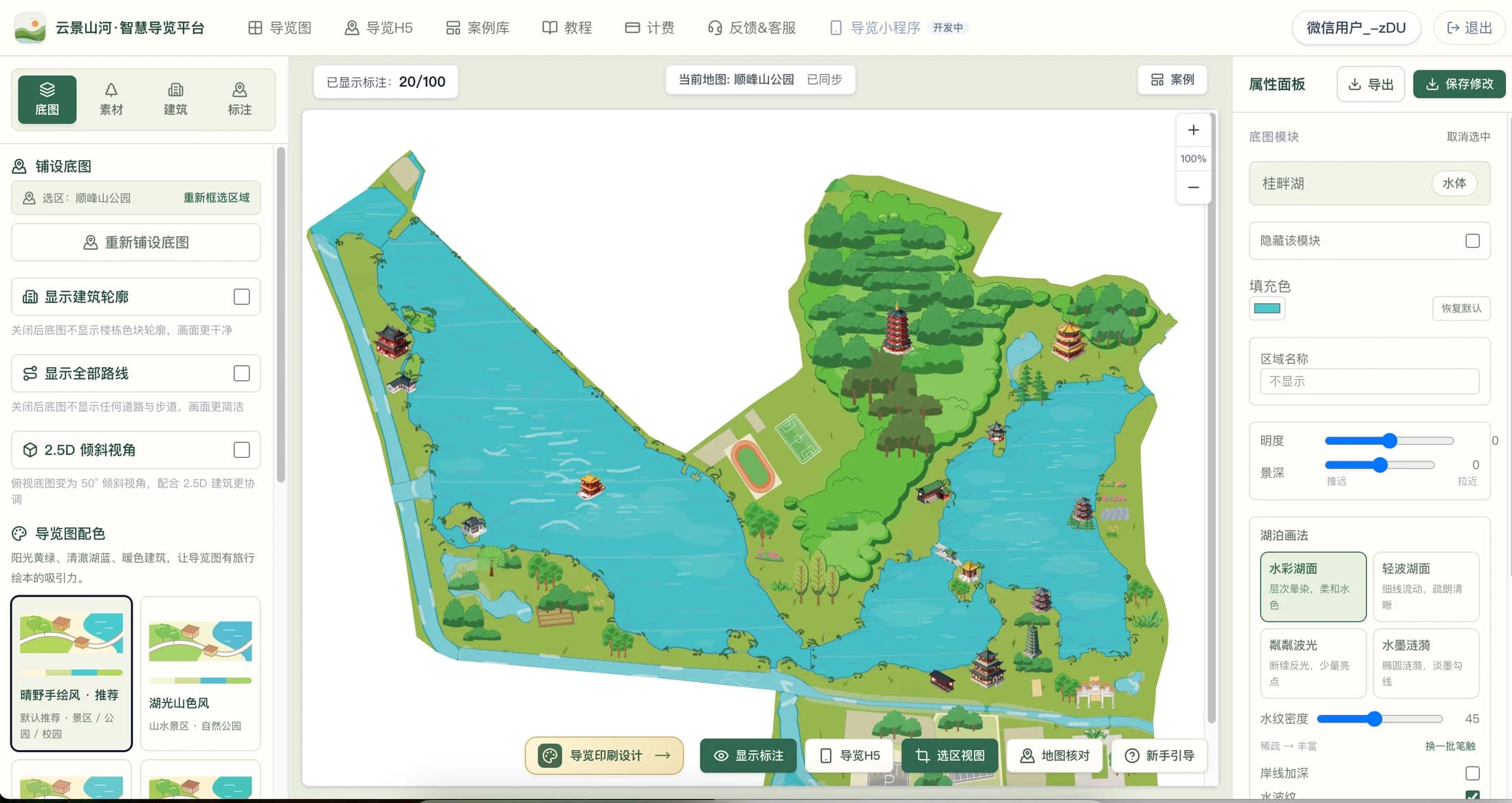
What-you-see-is-what-you-get Illustrated Map editor
Drag and drop assets, buildings, and annotations; venues such as courts and parking lots are placed at real scale
One-click theme coloring: tap areas like forests, lakes, and plazas to change effects instantly
Switch to a 2.5D tilted view and export files for print.
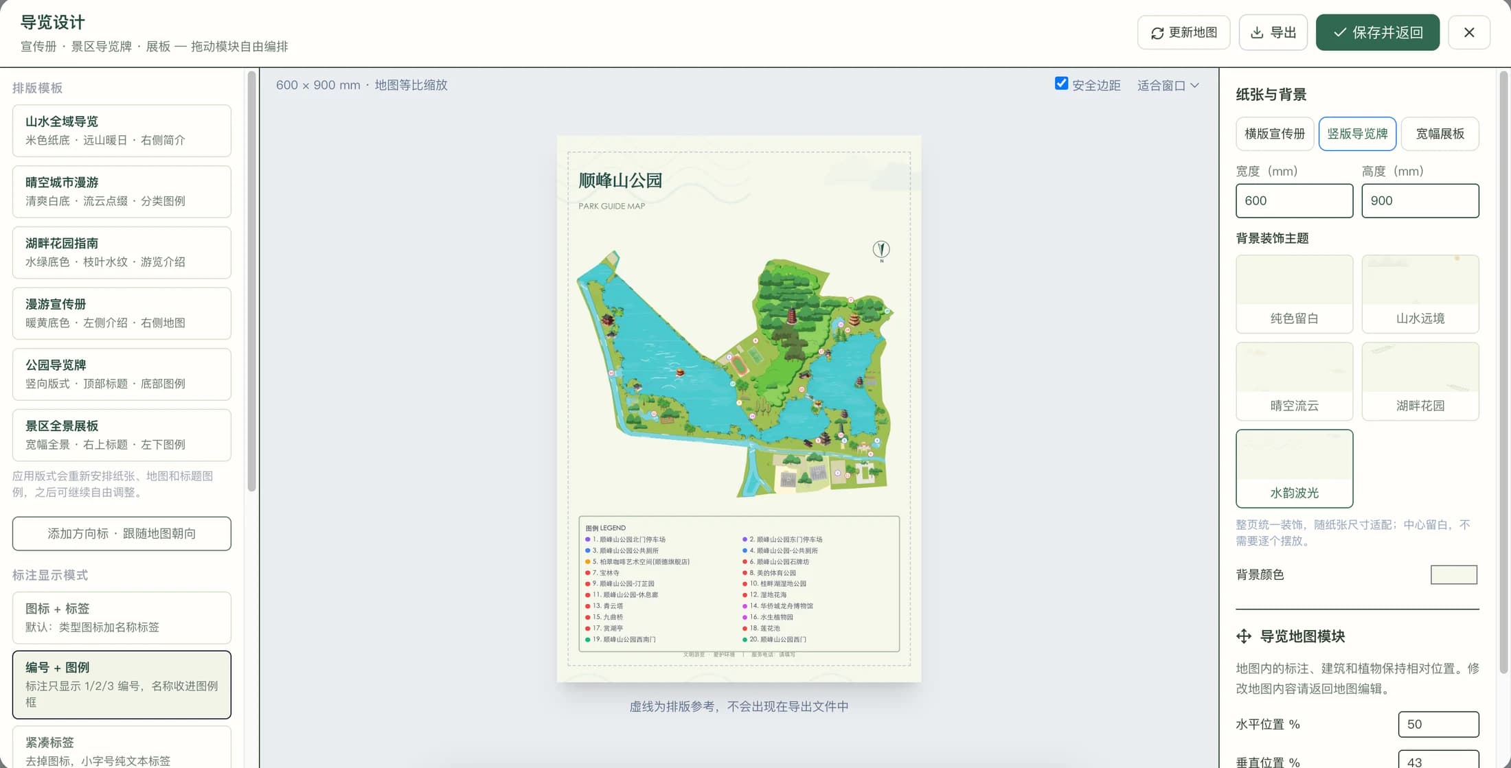
Bring Illustrated Maps into brochures and scenic area guide signs
Unified layout of map, title, numbered legend and background theme, from online production to print delivery, fully presenting the guide image of the scenic area.
One workflow for all types of scenic areas
The following Illustrated Maps are all deterministically generated by the platform system: from lake scenic areas to classical gardens, just select an area to generate the map.
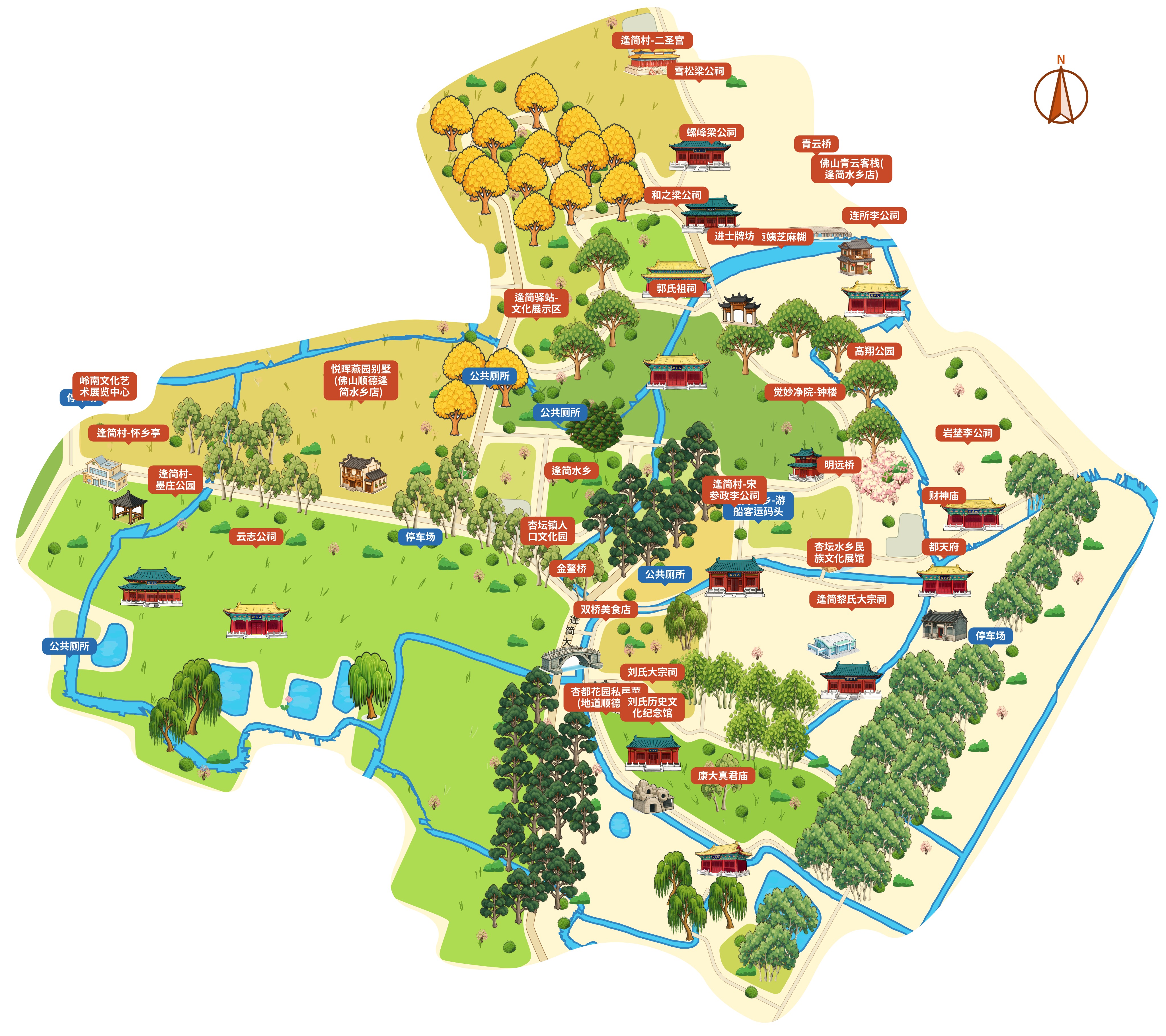
古村落-演示
Village
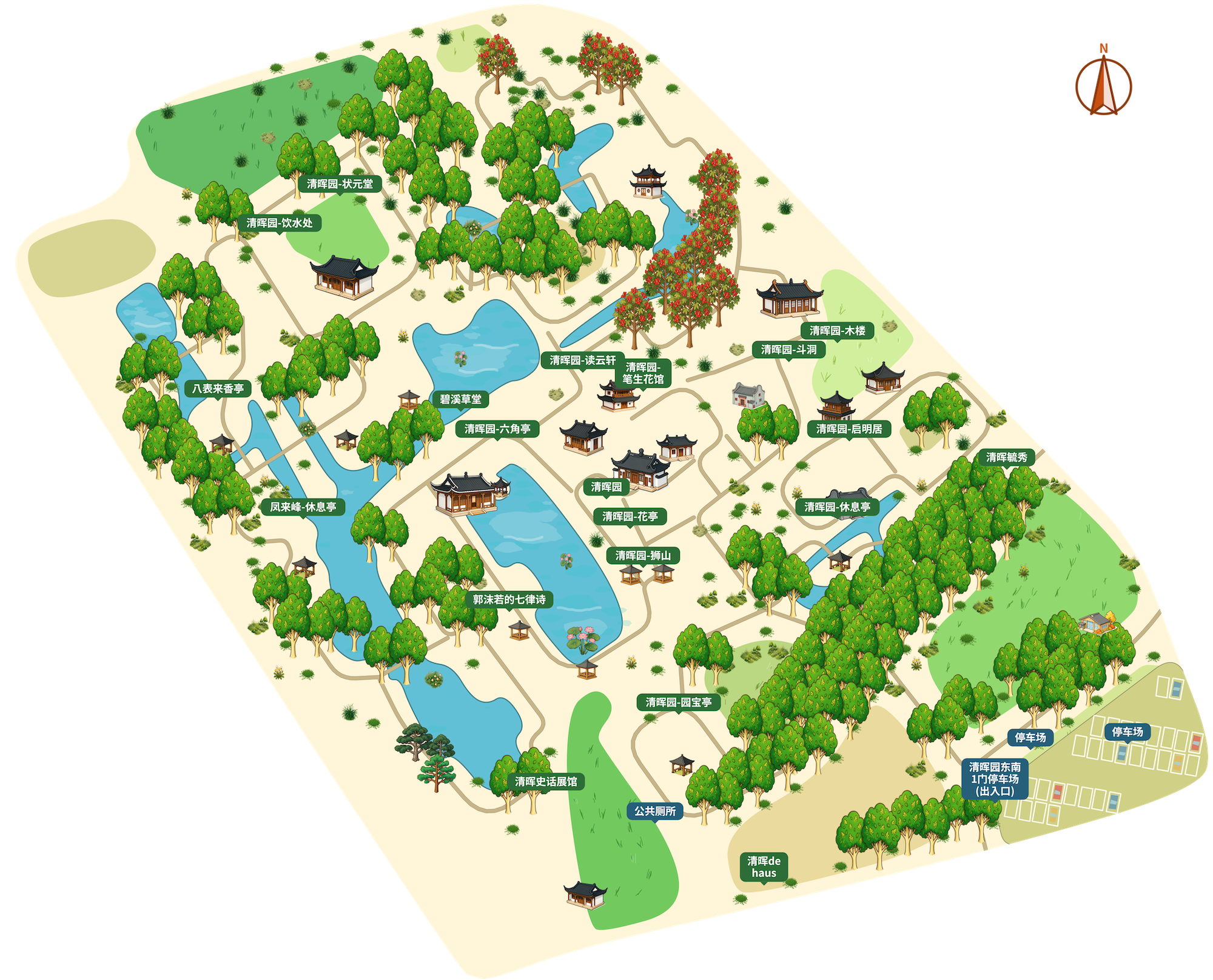
园林
Garden
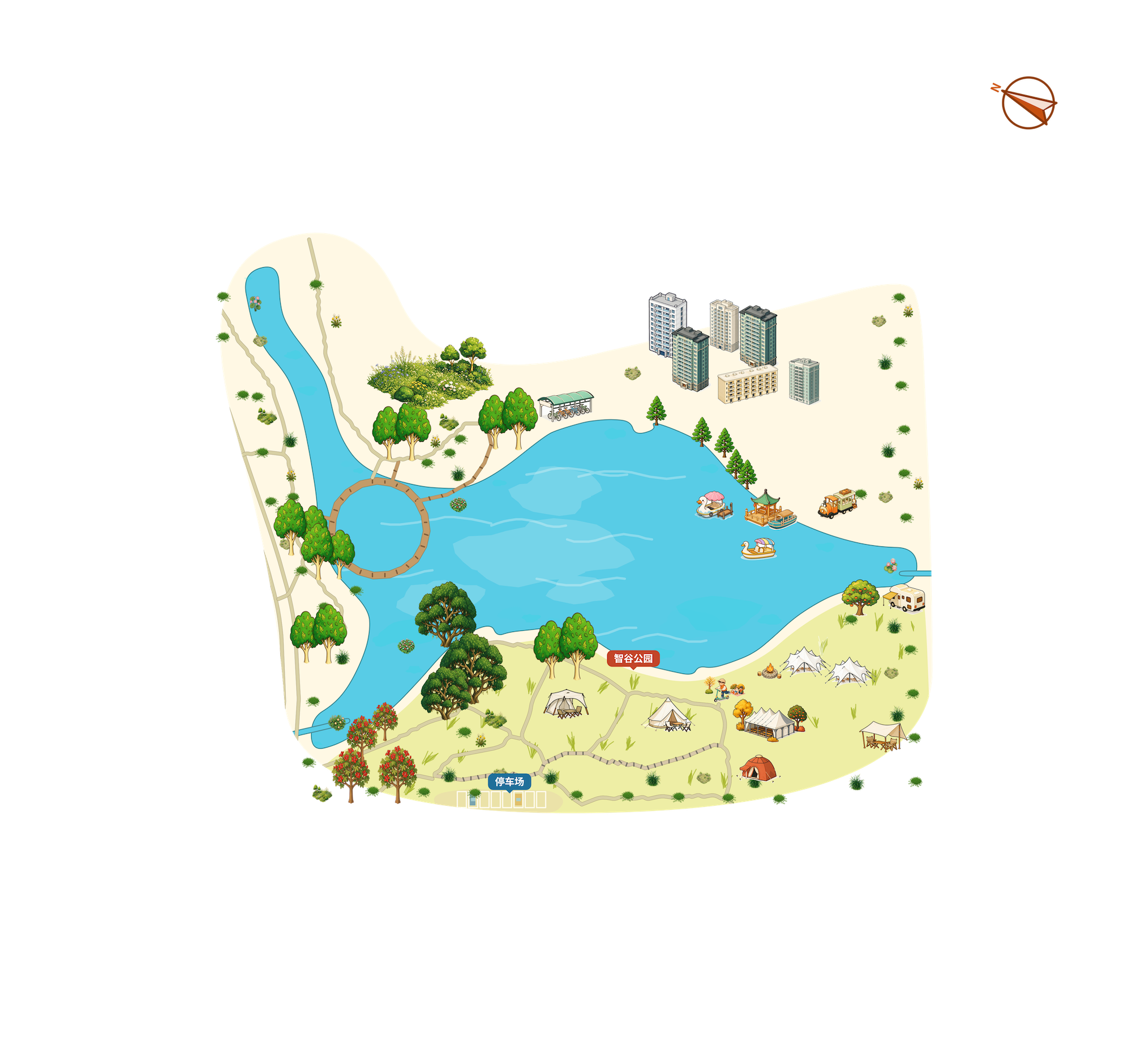
公园
Park
Create · Publish · Continuous Update
Find the guide creation method that suits you
A good hand-drawn map should be both appealing and easy to navigate. YunMap integrates real geographic areas, hand-drawn style base maps, building materials, and attraction annotations into a single online editing workflow, ideal for scenic spots, parks, campuses, and industrial parks to create their own Illustrated Maps.
Smart Guide PlatformVisitors need more than just a beautiful map — they need to know where to enter, where to go next, and where the nearest public restroom is. Smart guides organize the map and this information together, creating a complete tour experience that combines on-site guidance and mobile viewing.
Digital Guide H5Place the QR code at entrances, brochures, or service desks — visitors can open the guide map with their mobile phones. Digital Guide H5 is suitable for scenarios where visitors need to quickly view scenic spots and facilities, and it is also convenient for operators to maintain content after scenic spot information changes.
System-rendered, every map is consistently high-quality
Hand-drawn style maps are rendered by the system, and AI can assist in the creation and arrangement of buildings and materials: all geographic data, rendering rules, and style parameters are fully determined — for the same selected area and same style, the result is identical no matter how many times you render it. From base maps to guide experiences, every feature is designed for real-world use.
Standard hand-drawn style map creationExclusive advantages
Hand-drawn style map creation is a standard platform feature: the system generates maps based on real geographic data and style rules — the same selection area and style produce identical results no matter how many times you draw; hand-drawn illustrated maps and smart guides are produced from the same source, created once and usable on both ends.
Commercial Interaction Standard
Guide is business: route guidance for visitors, announcement reach, categorized traffic diversion, one-click dialing and navigation — every interaction point serves your business.
Ultra HD Export
Ultra HD export in SVG / PNG / PDF; vector quality ready for display boards, tickets and printed materials.
Quickly create assets
Assets are created in minutes with unified style, ready to use anytime — no more waiting for design schedules.
Fast, high-fidelity restoration of real buildings
AI quickly restores real buildings with high accuracy, making landmarks instantly recognizable so visitors never get lost.
Low cost
Lightweight investment: get the full capabilities of both hand-drawn illustrated maps and smart digital guide H5 in one go.
High Efficiency
Minute-level completion from area selection to map output: make the map in the morning and it can be used by visitors in the afternoon.
Modify at any time
Attractions, routes and announcements can be edited anytime and take effect immediately, so visitors always see the latest version.
One platform: hand-drawn style Illustrated Maps × smart guidance
Traditional Chinese and English Digital Guide H5 are coming soon. You can create, edit and export illustrated maps now.
Hand-drawn Style Illustrated Maps
The system generates hand-drawn style maps based on real geographic data, with minute-level rendering and consistent results for the same selected area; it supports ultra-high-definition export in SVG / PNG / PDF, suitable for display boards, tickets, and printed materials.
Create a map for freeSmart Guide · Digital Guide H5
Traditional Chinese and English Digital Guide H5 are coming soon. You can create, edit and export illustrated maps now.
Learn about Digital Guide H5Smart guides work for all types of spaces, not just scenic areas
Any space where 'people visit and need to find places' can use the smart guide platform to create maps and configure visitor services.
Scenic Area Attractions
Hand-drawn illustrated maps and QR code digital guides for natural and cultural scenic spots such as mountains, lakes, and forest parks
Park Green Space
Urban parks, wetland parks, greenways — facility annotations and recommended tour routes all in one place
Ancient Towns and Villages
Ancient town blocks and historical-cultural villages with highly restored buildings, so visitors can find their way without getting lost
Campus guide
Orientation guide for university, primary and secondary school orientation events — clearly show teaching buildings, dormitories, and canteens on one map
Park Industry
Industrial parks, science parks, and creative parks with clear presentation of building distribution and visitor movement routes
Theme Park
Ride listings, show times, and queuing routes — all travel tips in one map.
Zoo & Botanical Garden
Exhibition area distribution and popular science point markers, so family visitors can follow the map without backtracking
Museum Exhibition Hall
Venue navigation and exhibition area guidance, paired with announcements to deliver temporary exhibition information
Camping base
Scan the code to check campsite distribution, supporting facilities, activity areas and on-site guides instantly
Resort Hotel
The distribution of hot springs, swimming pools, restaurants and guest rooms in the resort is guided to guests with one map.
Commercial Block
Pedestrian streets, night markets, cultural and commercial streets: store category guidance directs visitors into shops
Factory Visit
Industrial tourism, visit routes, and exhibition hall points make reception and commentary more efficient
Select, edit and export in 30 minutes
Define Area
Search on OpenStreetMap and select an area to obtain outlines as a drawing reference.
Style Drawing
Choose from styles such as Q-version cartoon, traditional Chinese green landscape, red brick industrial, and more. The system draws a clean hand-drawn base map according to deterministic rules — the same selection area and style will always produce stable results.
Edit export
Adjust place positions and labels, then export SVG, PNG or PDF for print.
How to make a hand-drawn map and how to choose the right tool?
Understand the differences between online hand-drawn map generation, editable base maps, and QR code guided tours, then start creating based on the actual needs of your scenic area, campus, or park.
Introduction to YunMap Hand-Drawn Map Platform
Applicable scenarios, map editing, export formats, and digital guide H5 capabilities.
Reading Instructions →How to choose a hand-drawn map generator?
Compare applicable use cases for online creation, AI-generated images, and hand-drawn illustrations.
Reading Instructions →Scenic Area Hand-drawn Map Production Process
From real road and location data to print and mobile guide delivery.
Reading Instructions →What is the relationship between smart guide platforms and hand-drawn map production?
Traditional Chinese and English Digital Guide H5 are coming soon. You can create, edit and export illustrated maps now.
How to make a scenic area illustrated map? Can you make one without design skills?
No design experience is needed. Select an area on OpenStreetMap, generate an illustrated base map, then edit buildings, labels and styles. AI layout is optional and starts only when you choose it.
How long does it take to generate an Illustrated Map?
It usually takes only a few minutes from selecting an area to generating the map. After generation, you can repeatedly modify the base map, labels, and style, and export only when you are satisfied.
Can I try it for free?
Yes. After signing up, you can try illustrated map creation, asset and building editing, and markers. Check Pricing and your account for current free limits. AI layout runs only when you choose to use it. Free exports include a watermark; a paid plan provides watermark-free, high-resolution exports.
Can hand-drawn maps be printed on tickets and guide signs?
Yes. It supports ultra-high-definition export in SVG, PNG and PDF formats, with vector quality that can be directly used for printed materials such as tickets, display boards and guide signs.
How do visitors use the Digital Guide H5? Do they need to download an app?
Traditional Chinese and English Digital Guide H5 are coming soon. You can create, edit and export illustrated maps now.
Can spaces like campuses, industrial parks, and ancient towns also be made into guide maps?
Yes. The platform is applicable to various spaces such as scenic spots, parks, campuses, industrial parks, ancient towns, theme parks, zoos, museums, camping bases, resorts, commercial streets, etc., with one workflow for map output.
Is it compatible with mobile phones, tablets, computers and mini programs?
Traditional Chinese and English Digital Guide H5 are coming soon. You can create, edit and export illustrated maps now.
Make a free Illustrated Map
Vector base map 10 times per month · Free for long term · No download or installation required