
YunMap · Illustrated Map Creation Guide
Create hand-drawn maps online, giving real spaces their own artistic style
A good hand-drawn map should be both appealing and easy to navigate. YunMap integrates real geographic areas, hand-drawn style base maps, building materials, and attraction annotations into a single online editing workflow, ideal for scenic spots, parks, campuses, and industrial parks to create their own Illustrated Maps.
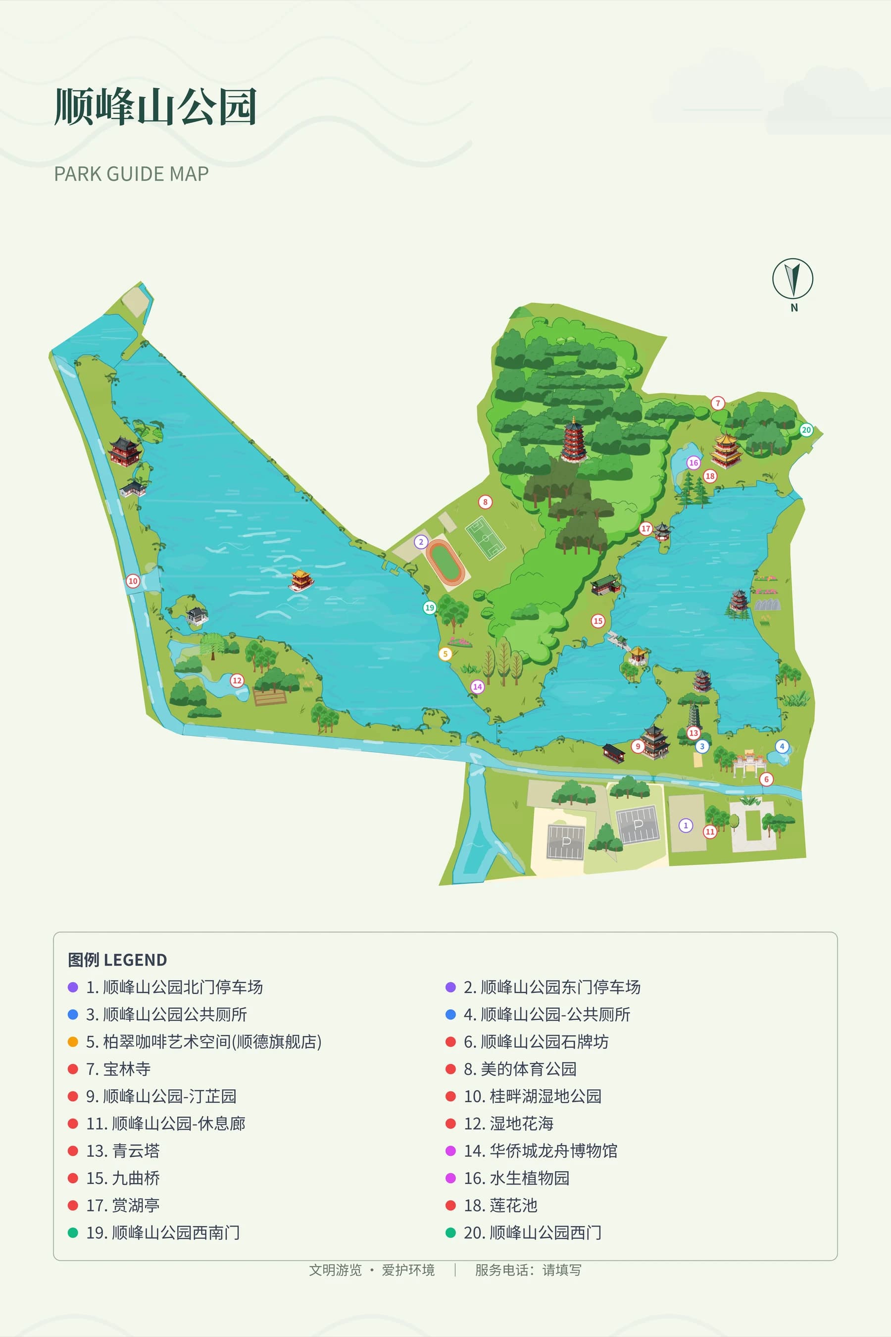
What can a hand-drawn map generator do?
YunMap provides online Chinese hand-drawn map creation: after selecting a real area, the system draws a hand-drawn style base map based on geographic data and style rules, then you can edit roads, building assets, and location labels. Finished works can be exported as SVG, PNG, PDF according to your benefits, or published as an electronic Digital Guide H5. Suitable for Illustrated Maps of scenic areas, campuses, parks, and industrial parks; map roads, entrances, and facility information need to be verified against on-site data.
Hand-drawn style maps: accuracy first, beauty second
Promotional illustrations allow free composition, but illustrated maps require consideration of entrance locations, road accessibility, and travel routes between attractions. Before production, confirm the area boundary and key roads first, then decide on the art style. The system lays the base map based on the real selected area, and the hand-drawn style is generated and rendered by the system. After the map is generated, you still need to verify roads, entrances and exits against on-site conditions; do not judge route accessibility solely by the visual appearance.
Forests, grasslands and lakes form clear visual layers
If a large green area is filled with only one color, scenic spots and paths can easily blend together. The editor provides woodland, grassland and water effects, with adjustable grass density and area styles. First keep roads and water areas clear, then use buildings, trees and a small number of decorations to emphasize key points. Highlights are used to show layers, avoid covering the main color; different areas do not need to use the same texture density.
From electronic images to guide print design
After the map is completed, you can export it as SVG, PNG or PDF. When using it for brochures or guide signs at scenic area entrances, enter the guide print design module, adjust the position and size of the map as a component, then arrange the title, legend, logo, descriptive text and background theme. Check font sizes, numbering and orientation according to the actual size. Before sending to print, confirm the size, resolution and color requirements with the printer.
Online hand-drawn map SaaS, suitable for continuous updates
SaaS refers to software services accessed through a web browser. YunMap's hand-drawn style map SaaS platform moves map creation and editing online, making it easy to update content when scenic spot names, service facilities or park layouts change. When choosing a tool, in addition to comparing art styles, you should also check whether you can edit labels, adjust areas, export required formats, and support subsequent digital guide publishing.
Four steps from preparation to delivery
- 01
Prepare Areas and Materials
Confirm scenic area boundaries, entrances, main roads, attraction names and building reference images. Create a new illustrated map and frame the area to be produced.
- 02
Select a theme and refine the base map
Lay the hand-drawn base map, check roads and water areas, and adjust the style and density of forests, grasslands, and lakes to make routes easy to identify.
- 03
Add buildings and labels
Place building and plant assets, organize and label them by type such as scenic spots, parking lots, and public restrooms, and verify names and positions.
- 04
Delivered by use case
Export the map when you need images; do print layout when you need guide signs; continue to make a Digital Guide H5 when you need QR code access.
FAQ
Can I make a hand-drawn map even if I can't draw?
You can start creating from the selected area, base map theme and existing materials, without drawing stroke by stroke. You still need to verify the actual geographic relationships, label positions and on-site information, and adjust the layout according to the usage scenario.
Does AI hand-drawn map generate a random image?
Hand-drawn style guide maps are a system rendering capability: the base map is rendered based on the actual selected area and style rules, and AI can be used for auxiliary links such as building and material creation and arrangement. After the map is created, you can continue to modify regional effects, building materials, and annotations — it is not just a static random image that cannot be edited further.
Can hand-drawn maps be used for printing?
You can export SVG, PNG, PDF and use them for guide print design and layout. The free version exports with watermarks, and 4K HD / 8K Ultra HD are paid version features; please check the export effect before official delivery and confirm the final file according to the printer's requirements.
Production and publishing benefits are subject toActivate Membershippage shall prevail. The free version exports with watermarks; 4K HD / 8K Ultra HD are paid features. Please verify the map and on-site information before official launch.
Create · Publish · Continuous Update
Find the guide creation method that suits you
A good hand-drawn map should be both appealing and easy to navigate. YunMap integrates real geographic areas, hand-drawn style base maps, building materials, and attraction annotations into a single online editing workflow, ideal for scenic spots, parks, campuses, and industrial parks to create their own Illustrated Maps.
Smart Guide PlatformVisitors need more than just a beautiful map — they need to know where to enter, where to go next, and where the nearest public restroom is. Smart guides organize the map and this information together, creating a complete tour experience that combines on-site guidance and mobile viewing.
Digital Guide H5Place the QR code at entrances, brochures, or service desks — visitors can open the guide map with their mobile phones. Digital Guide H5 is suitable for scenarios where visitors need to quickly view scenic spots and facilities, and it is also convenient for operators to maintain content after scenic spot information changes.