
Campsite Map Maker | Pitch Layouts & RV Park Visitor Maps
When creating a campsite visitor map, first separate vehicle traffic areas, walking paths and campsite zones. After compiling the camp boundary, site numbers, reception location and list of public facilities, you can create a real-area base map in MapRove, then draw in campsite zones and add labels. Campsite dimensions, power hookups and availability status must be provided by the camp operator; the geographic base map does not automatically generate accurate operational campsite data.
MapRove product guide · Updated
What materials do I need to prepare before making a camp map?
List out the bring-your-own-tent area, fixed tent area, RV area and public activity area separately, and record each campsite number, reception desk, parking area, restrooms, showers and water points. Use the same numbering format as your booking system and on-site site markers; do not list seasonally closed areas as available campsites.
How do I distinguish RV lanes from visitor walking routes?
Use different line styles for vehicle entrances, unloading points and pedestrian shortcuts, and mark the arrival sequence from reception to campsites. The camp operator must verify whether narrow bridges, ramps and turns are passable for RVs based on vehicle specifications. Pay special attention to paths near children's activity areas; a map cannot replace on-site traffic and safety management.
How do I choose a hand-drawn style campsite map template?
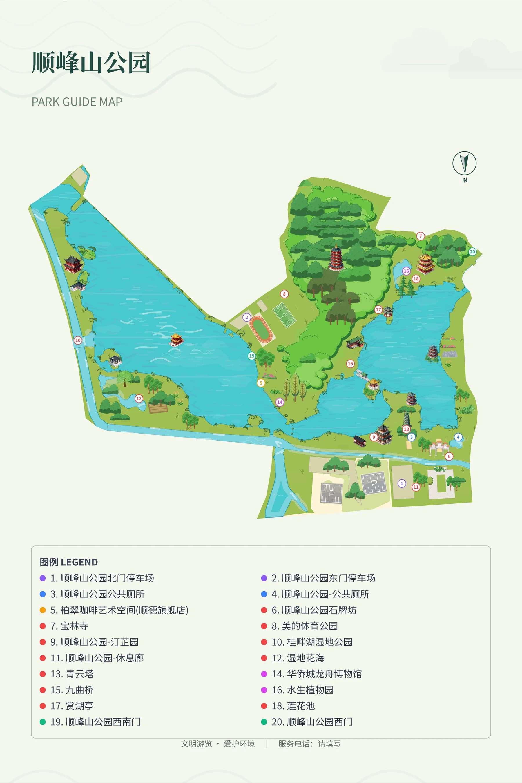
First compare zone layout, numbering, public facility legends and white space, then consider decorative illustrations like tents and trees. Park reference images can only be used to learn from road and legend hierarchy — they cannot be used directly as a campsite base map. For high-density campsites, use numbers linked to a service list instead of placing full descriptions next to every tent.
How do I deliver camp wayfinding signs and guest check-in maps?
For the entrance overview sign, highlight reception and the current location; for check-in pocket cards, highlight the campsite number and service facilities. Export files in PNG, SVG or PDF according to your plan, then check the actual font size for readability. Use a campsite version number to align the booking page, reception materials and wayfinding signs; update all three whenever campsite arrangements change.
Frequently asked questions
What online tool can I use to make a campsite visitor map?
You can use MapRove to create an area base map and edit zones, roads and labels. Start with a draft using camp-verified campsite data, then export according to your plan. Ready-made geographic data does not include complete campsite facility information.
Can an RV campground site plan be generated automatically?
A geographic base map can be generated as a starting point for editing, but campsite dimensions, turning space, power and water/sewage configurations require on-site measured data. A visitor map is not intended for use as an engineering site plan for the campground.
Can I download campsite map templates for free?
Sample images are for previewing design effects only and do not represent downloadable engineering templates. Platform free trial access, export watermark policies and high-resolution benefits are listed on the pricing page. Always check licensing before using third-party tent icons.
How do I mark barbecue areas and fire pits on a camp map?
Only mark areas that the management has confirmed are approved for use, and keep the names consistent with on-site signage. Operating hours, weather restrictions and usage rules should be listed separately in operational documentation maintained by the camp operator.
Related map design workflows
- Resort, Hotel & Campsite Map Maker
- Park, Garden & Botanical Map Design
- Outdoor Learning Map Maker | School Visits & Activity Routes