
Shopping Street Map Maker | Store Directories & Food Maps
A commercial street visitor map organizes lanes, entrances, shops and service facilities into a map easy to follow on foot. When making one, first define the block boundaries and stable building numbers, then arrange categories for dining, shopping, culture and services. Since merchant rosters change, it is recommended to keep stable location numbers, then maintain shop names and operating information.
MapRove product guide · Updated
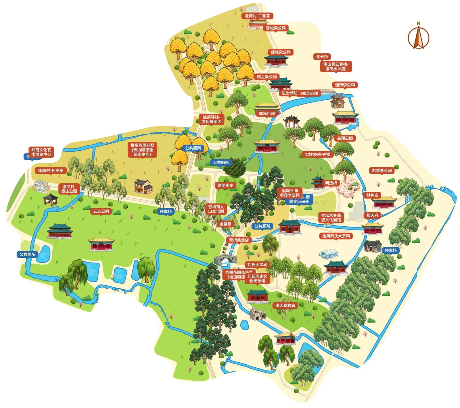
For a pedestrian street map, should you draw entrances first or shops first?
First mark bus stops, subway exits, parking lots and block entrances to establish the spatial relationship for entering and leaving. When a commercial street crosses motor vehicle roads, verify crossing locations, footbridges and underpasses — adjacent shops on the map may not be directly reachable on foot.
How do shop distribution maps handle tenant turnover?
Keep stable numbers for street sections and shop units, and treat current merchant names as updatable labels. Set up legends for dining, retail, culture and services, and select highlighted shops based on map-reading goals; do not rely on a collage of all shop logos that becomes hard to maintain.
How can a hand-drawn food map look good and still work for wayfinding?
Use illustrations to highlight street corners, buildings and a small number of recognizable landmarks, and keep enough contrast between routes and shop names. When referencing the alley expression of ancient village maps, replace them with real block data. Mark the roster verification date on the map, and leave operating hours and reservation information to updatable channels.
What is the difference between a block wayfinding sign map and a leasing map?
The visitor version highlights destinations, rest areas, restrooms and exit routes, while the leasing version may require shop unit numbers and business zoning. You can reuse the base map but lay out the two versions separately, to avoid putting internal operating materials directly on public wayfinding signs; have the operator verify shop names and locations before formal printing.
Frequently asked questions
What software do you use to make a hand-drawn commercial street map?
You can use MapRove to create a base map from a real block, and edit streets, buildings and merchant labels. First verify the shop list and entrances, then export according to your plan for layout in brochures or on wayfinding signs.
Can you directly replace shop names in a food map template?
You may only reuse the layout when the positional relationships are also correct. For different blocks, replace the base map and shop positions, and all shop names, door numbers and operating information must be verified by the operator.
Can a commercial street map show real-time operating status?
Static maps do not automatically receive operating status. You can keep stable locations on the map and use a separately maintained detail page to explain business hours and temporary changes.
How do you avoid overlapping text on a map with many shops?
Use shop unit numbers paired with a categorized index, keep short names for important shops, and create separate local zoomed-in views for busy street sections. Always check against the final mobile image or print size, not just the zoomed-in view during editing.
Related map design workflows
- City Tourist Map Maker | Design an Illustrated Visitor Map
- Old Town & Village Map Maker | Rural Visitor Map Design
- Guesthouse Area Map Maker | Arrival Guides & Walking Maps