
Guesthouse Area Map Maker | Arrival Guides & Walking Maps
A guesthouse neighborhood map should first solve the last leg of a guest's journey to the property, then offer optional walking tours. Build it on verified parking spots, the inn entrance and stable nearby landmarks, and edit the base map and labels in MapRove. Place access codes and private contact details through appropriate check-in channels; public maps should only display service information suitable for public release.
MapRove product guide · Updated
How do you draw the route from the parking lot to the guesthouse entrance clearly?
Connect the parking area and reception entrance with a field-verified path, and mark key turns, bridges and house numbers. When vehicles are banned inside an ancient town, clearly indicate the drop-off point and the walking segment. Night-visible landmarks are more reliable than directions that rely on temporary stalls.
What size area should a local food map cover?
Choose a range around common guest errands, such as breakfast spots, convenience stores, bus stops and a small number of attractions. Keep official shop names and the last verification date, and update promptly if shops relocate or close. Walking times should be based on on-site checks, not estimated directly from straight-line distance.
How do you customize an inn hand-drawn map template for your own property?
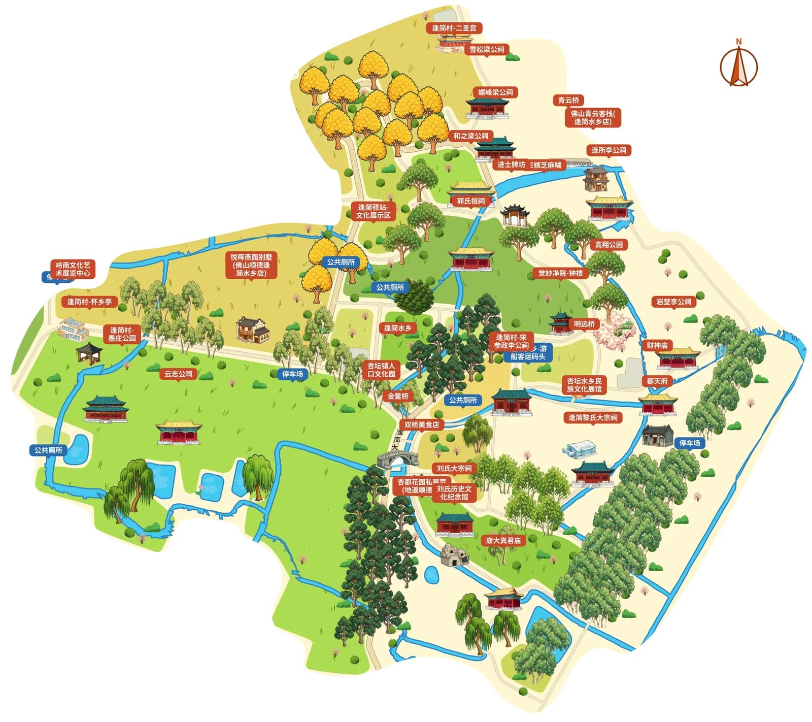
Draw on the street and bridge expression of the ancient village reference map, and replace them with the actual roads of the guesthouse's area. Prioritize entrances, parking and service facilities, and reduce decorative buildings to only those that help with orientation. Avoid taking another village's map and only changing the title to use it as a check-in guide.
What should you check for printed check-in cards versus mobile maps?
For printed cards, check font size, map orientation and QR code white space. For mobile images, verify that the entrance is still recognizable after compression in chat apps. Keep editable project files and update the version date; make sure route information sent before arrival matches on-site house numbers.
Frequently asked questions
What software do you use to make a guesthouse neighborhood map?
You can use MapRove to select the surrounding area, edit roads, entrances and location labels, then export images or print files according to your plan. It is recommended to first verify one actual arrival route on site.
Can a hand-drawn guesthouse map be made into a navigation QR code?
A map image and real-time navigation are separate deliverables. You can include a QR code for a verified navigation link in the layout. The availability status and publishing rights for guide H5 pages should be checked separately on the product description and billing pages.
Can you put nearby business logos on a guesthouse map?
Prioritize clear shop names and universal service icons. Confirm usage authorization before using business logos, photos or other illustrations, and regularly review recommended listings and operating information.
Does an inn check-in route map need to show every small alley?
No, it does not. Keep the main road, turns and easy-to-miss forks needed to reach the property. For complex areas, you can add a local inset map to make sure guests can follow on-site landmarks step by step.
Related map design workflows
- Resort, Hotel & Campsite Map Maker
- Old Town & Village Map Maker | Rural Visitor Map Design
- Shopping Street Map Maker | Store Directories & Food Maps