
Suitable for:Operation and content production staff for scenic areas, parks and ancient towns
How to create a scenic area illustrated map? Complete workflow from data organization to publication
First verify the real space clearly, then decide on the art style and delivery form. Scenic area Illustrated Maps should simultaneously answer "Where am I, where am I going, and how do I get there".
Content Verification:
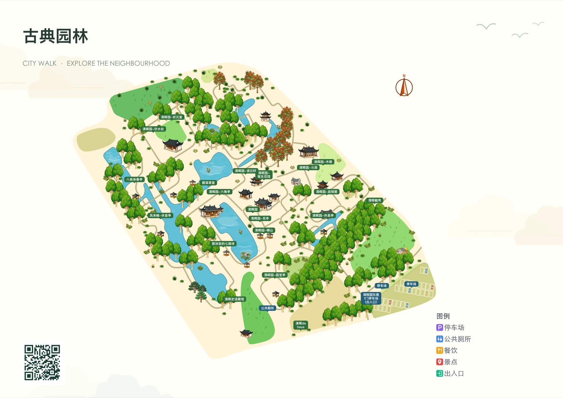
Read the conclusion first
- First confirm the area boundaries, passable roads and entrances/exits, then lay out the base map.
- Annotations and recommended routes shall be subject to on-site verified information.
- Print files and mobile guides require separate checks for font size, interaction, and access methods.
1. Prepare verifiable spatial data
Before production, list the scenic area boundaries, primary and secondary entrances and exits, roads and trails, water areas, parking lots, public toilets, visitor centers and main attractions. Names should be based on on-site signs or information confirmed by the operator; closed roads and temporary construction areas should also be recorded.
Existing satellite imagery, vector maps and on-site photos can be cross-checked with each other. Satellite imagery helps identify terrain and buildings, vector maps facilitate road recognition, and on-site materials are used to confirm whether a route is actually passable. In case of conflicts among the three, the on-site manager shall review and verify before the map goes live.
Checklist
- Area Boundary and Orientation
- Entrance and main tour routes
- Attractions, service facilities and their accurate names
- Building appearance reference images and on-site photos
II. Lay out roads and water areas first, then arrange visual effects
After selecting an area and laying the base map in YunMap, first check whether roads are connected, whether water surfaces cover roads, and whether the route from the entrance to main attractions is clearly identifiable. Effects such as forests, grasslands, and lakes are used to express environmental layers and cannot replace accurate road information.
Hand-drawn style maps are base maps rendered based on geographic data and style rules, and you can still adjust regions, building materials, and annotations in the editor later. Garden paths with missing geographic data can be supplemented during the editing stage and calibrated with on-site data.
3. Organize Markers and Routes by Visitor Tasks
Prioritize annotations for high-frequency facilities such as entrances, parking lots, restrooms, and visitor centers, then arrange scenic spots, dining venues, and activity locations. Short names on the map are for quick positioning, while longer introductions are placed in the details. Recommended routes should specify the start point, end point, and stops along the way.
Before official release, walk through the visitor's perspective on your phone: can they find the nearest restroom, can they reach the main attractions from the entrance, and is the destination correct after tapping navigation? This step improves the guide experience more than adding more decorations.
IV. Complete Delivery According to Usage
For guide signs and brochures, check the final physical dimensions, font readability, legend, orientation, and QR code scanning test. For Digital Guide H5, check mobile loading, categories, details, routes, location authorization, and external navigation redirection. The platform supports exporting SVG, PNG, PDF, and publishing Digital Guide H5 accessible via visitor QR code scanning. Specific export benefits are subject to the membership activation page.
FAQ
Are there no designers who can create scenic area illustrated maps?
You can start with the real area and the hand-drawn style base map drawn by the system, then edit buildings, greenery and labels; geographic location and access information still need to be manually verified.
Roads are visible on the satellite map but not on the base map. What should I do?
First verify with the vector map and on-site conditions; if the road is indeed passable, you can redraw or adjust the road in the editor and check the guide effect after publishing.
Can the illustrated map be printed directly after completion?
It is recommended to first check text and QR codes according to the actual printing size, then confirm file format, bleed, and color requirements with the printer.
Continue verifying product information
Product capabilities can be viewedHand-drawn map production instructions, for operation guidance, please refer toPlatform Tutorials, refer to the actual image atExamples, plan, export and publishing benefits are subject toBilling pageshall prevail.