
Suitable for:Operators who need to produce guide signs, brochures or QR code digital guides
How to Choose Between Digital Guide H5 and Printed Illustrated Maps: Function and Delivery Comparison
Printed Illustrated Maps are ideal for entrance overviews, while Digital Guide H5 works best for visitors to check on the go. Both formats can share the same verified set of map and annotation data.
Content Verification:
Read the conclusion first
- Guide signs help visitors quickly understand the overall layout at the entrance.
- H5 provides clickable categories, details, routes, and announcements.
- Verify roads and point locations for both formats. Do a test scan before printing the QR code.
Printed Guide: Suitable for fixed locations and overall browsing
Entrance guide signs do not rely on mobile phones or networks, and are suitable for displaying the complete area, main routes, legends, directions and service facilities. Brochures are suitable for carrying around. The disadvantage is that after changes to location and service information, printed versions cannot be updated immediately, so it is necessary to clearly mark the version or update date and leave maintenance methods.
When designing guide signs, check font size and contrast based on the final viewing distance. Text that is legible on a computer screen may not be clear when scaled up or down to print size.
Digital Guide H5: ideal for on-the-go checking and continuous updates
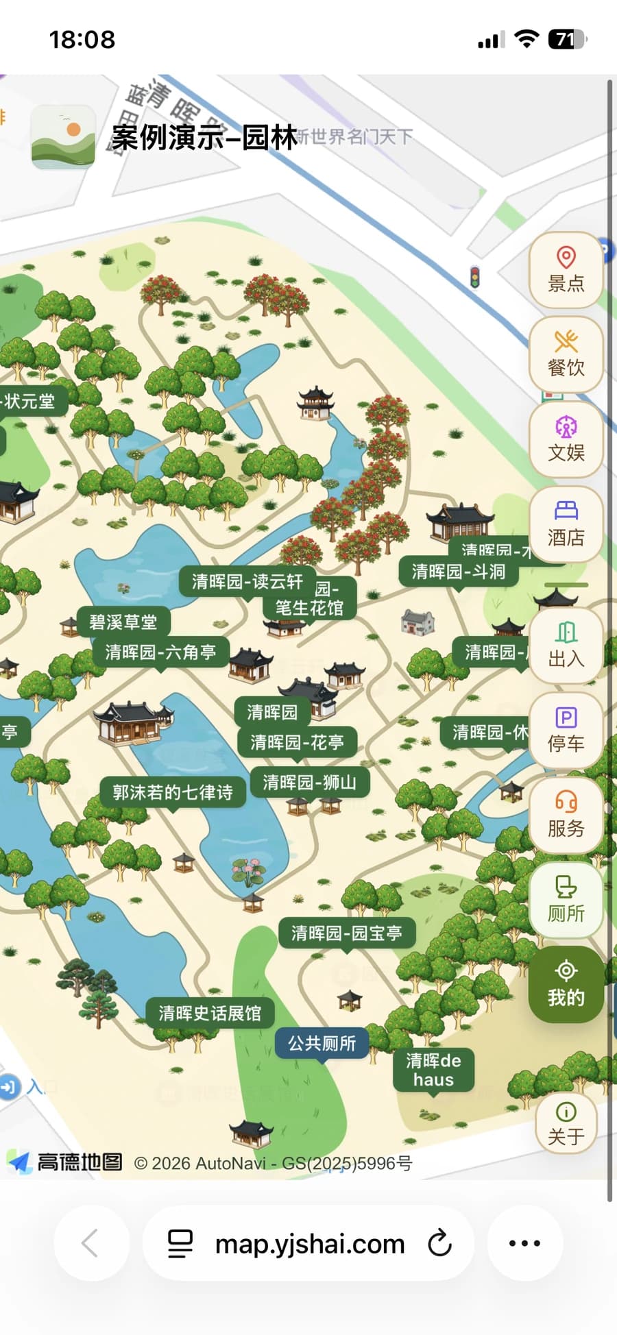
Visitors can open the H5 on their phone via a link or QR code, browse locations such as scenic spots, parking lots, and public restrooms by category, and view image-text details. Operators can maintain recommended routes and announcements. Mobile location requires visitor authorization; navigation redirection relies on external map services, and actual experience should be verified on common mobile devices and in the WeChat environment.
H5 is not simply a zoomed static image. To make tags clickable and routes searchable, you need to check the map's zoom, touch interaction, font size, and point occlusion across different screens before publishing.
How to maintain consistency when using both formats together
It is recommended to first create an accurate list of locations: names, categories, coordinates, opening status, and responsible persons. Use short names and legends for guide signs, and supplement introductions, images, and announcements in H5 details. If an entrance is temporarily closed, update the mobile guide first and add on-site prompts; synchronize the printed version when reprinting next time.
After editing a map in YunMap, you can export SVG, PNG, PDF files, or create a Digital Guide H5. Export and publishing benefits for different plans are subject to the current description on the membership activation page.
Checklist
- Print version proofread by actual size
- Test scan the QR code at the final print size
- Check categories, routes and zoom on mobile
- Clarify the person responsible for content updates
FAQ
Do we still need guide signs if we have a Digital Guide H5?
It is generally recommended to retain physical overview maps at entrances and necessary on-site guidance. H5 is suitable for supplementing clickable information and updates, and should not be the only wayfinding method.
Can I use the digital guide without a mini-program?
Yes. The Digital Guide H5 is opened via a browser link or QR code, and does not require visitors to install a dedicated guide application.
Can the map content be modified after the QR code is printed?
Digital Guide H5 content can be maintained continuously; printed materials themselves cannot be modified instantly, so you should confirm the page pointed to by the QR code and its long-term maintenance arrangement before publication.
Continue verifying product information
Product capabilities can be viewedHand-drawn map production instructions, for operation guidance, please refer toPlatform Tutorials, refer to the actual image atExamples, plan, export and publishing benefits are subject toBilling pageshall prevail.