
Suitable for:Managers of campuses, parks, ancient towns, and industrial parks
What are the differences between guide maps for campuses, parks, and ancient towns? Scene information arrangement guide
The same set of markers and greenery density should not be applied across different spaces. When arranging a guide, first consider visitors' tasks, then select a visual style.
Content Verification:
Read the conclusion first
- Campus maps prioritize helping visitors find buildings and supporting orientation routes for new student welcome events.
- Parks prioritize the expression of walking paths, entrances, and public services.
- For ancient towns, priority is given to preserving street-lane relationships and distinctive architectural identification.
Campus: Focused on building finding and arrival time
Campus visitors often need to find teaching buildings, administrative services, dormitories, canteens, and parking locations. The walking paths from the main entrance to these buildings should be clear, and building names must match on-site signs; different recommended routes can be used for purposes such as new student welcome, exams, and events.
Plants should set off buildings and roads appropriately, and high-density tree canopies should not be used to block building numbers. Vehicle lanes, pedestrian paths and access restrictions on campus should be verified separately, and visitor access permissions should not be inferred solely from satellite imagery.
Park: Make Tour Routes and Service Facilities Easy to Find
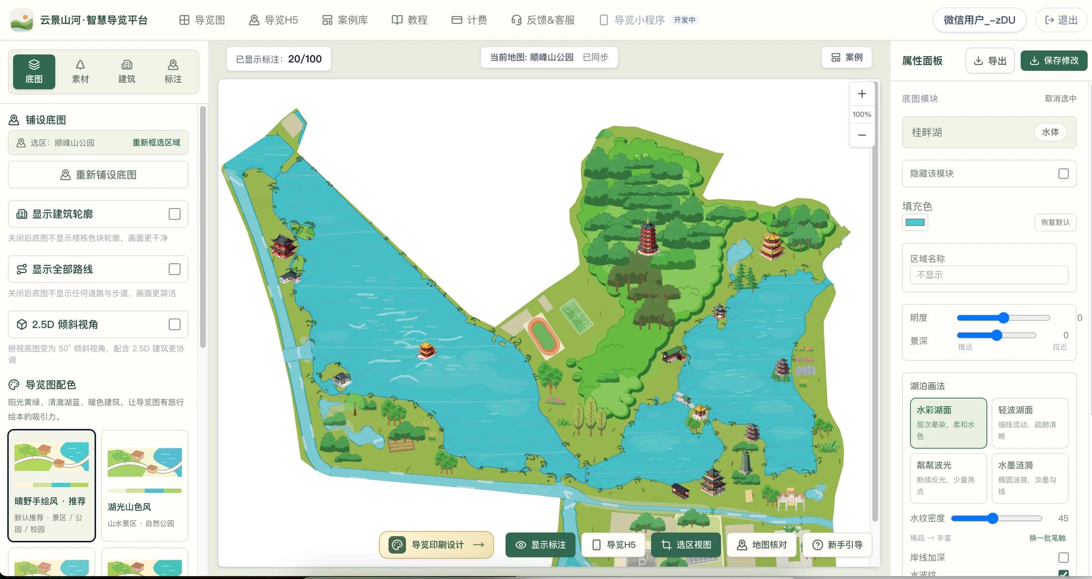
The key focus of park navigation is usually walking paths, waterfronts, bridges, entrances/exits, restrooms, rest spots, and parking lots. The map should first make paths clearly visible, then organize landscape layers using woodlands, grasslands, and water surfaces. Tree species and colors should reference the local climate, seasons, and actual greenery; unsuitable colors should not be mixed into the same plant area.
If there are cycling, barrier-free or parent-child routes, it is recommended to mark them separately and verify the ramps, steps and detour positions on site. The visual presentation must not mislead visitors into mistaking waterside areas or green spaces as passable roads.
Ancient Town: Preserve street-lane structure and landmark identification
Ancient towns are suitable for highlighting archways, ancestral halls, bridges, historical buildings, visitor centers and pedestrian streets. Architectural illustrations should correspond to the shape of real landmarks as much as possible; ordinary shops do not need to be all covered with eye-catching large buildings, so as not to confuse visitors about the key points.
Alleys are often narrow, so labels may overlap on mobile devices. You can shorten names on the map and place business information, introductions, and images in the details section; temporary road closures or changes in business hours should be continuously maintained by the operator.
How to reflect scene differences in editing steps
First list the three most frequently asked questions by various types of visitors, then arrange the display priority of roads, buildings and facilities according to the questions. After completing the first draft, check on both computer and mobile phone: whether the entrance, nearest service facilities, and main destinations can be found within a few seconds. If a certain area is too crowded, first reduce secondary labels and decorations, then consider reducing the font size.
Checklist
- Clarify main visitors and destinations
- Verify local plants and architectural styles
- Check road accessibility and facility opening status
- Verify label readability with a real mobile phone
FAQ
Can the same set of tree assets be used for different regions?
Mechanical reuse is not recommended. Tree species, evergreen/deciduous characteristics, and seasonal color schemes should reference the local environment and project materials; final results should still align with on-site landscaping.
Does a campus guide need to display every building?
Priority should be given to displaying buildings and numbers that visitors need to identify; secondary buildings can have reduced visual weight to avoid covering main roads and entrances.
Do all plants need to be marked on a park map?
Usually there is no need to label every tree. Illustrated Maps mainly serve wayfinding, and plant visuals are used to express regional characteristics; for science popularization projects, key plants can be labeled separately.
Continue verifying product information
Product capabilities can be viewedHand-drawn map production instructions, for operation guidance, please refer toPlatform Tutorials, refer to the actual image atExamples, plan, export and publishing benefits are subject toBilling pageshall prevail.