
Farm Visitor Map Maker | Pick-Your-Own & Family Farm Guides
A family farm visitor map should separate visitor-accessible areas from production work zones, to help families locate the reception desk, experience activities and rest services. First compile the farm boundaries, walking paths, plots and facilities, then add zoning and labels on the base map; picking varieties, experience session times and animal interaction rules are maintained by the farm.
MapRove product guide · Updated
How do you draw a farm map that is easy for parents to follow?
Structure the map around the main flow: parking, reception, activities and exit return. Prioritize marking restrooms, handwashing stations, shaded rest areas and dining spots. Verify and separate stroller-accessible paths from narrow field paths — never assume a line on the base map is suitable for strollers just because it appears there.
How should you arrange picking garden zoning and seasonal routes?
Use stable plot numbers for orchards and vegetable plots, and maintain crop varieties and current-season availability separately. Keep the plot and road layout on the main map, and use small seasonal icons to indicate current activities; when crop rotation or harvest ends, you do not need to redraw the entire geographic framework.
How do you combine farm illustrations with real locations?
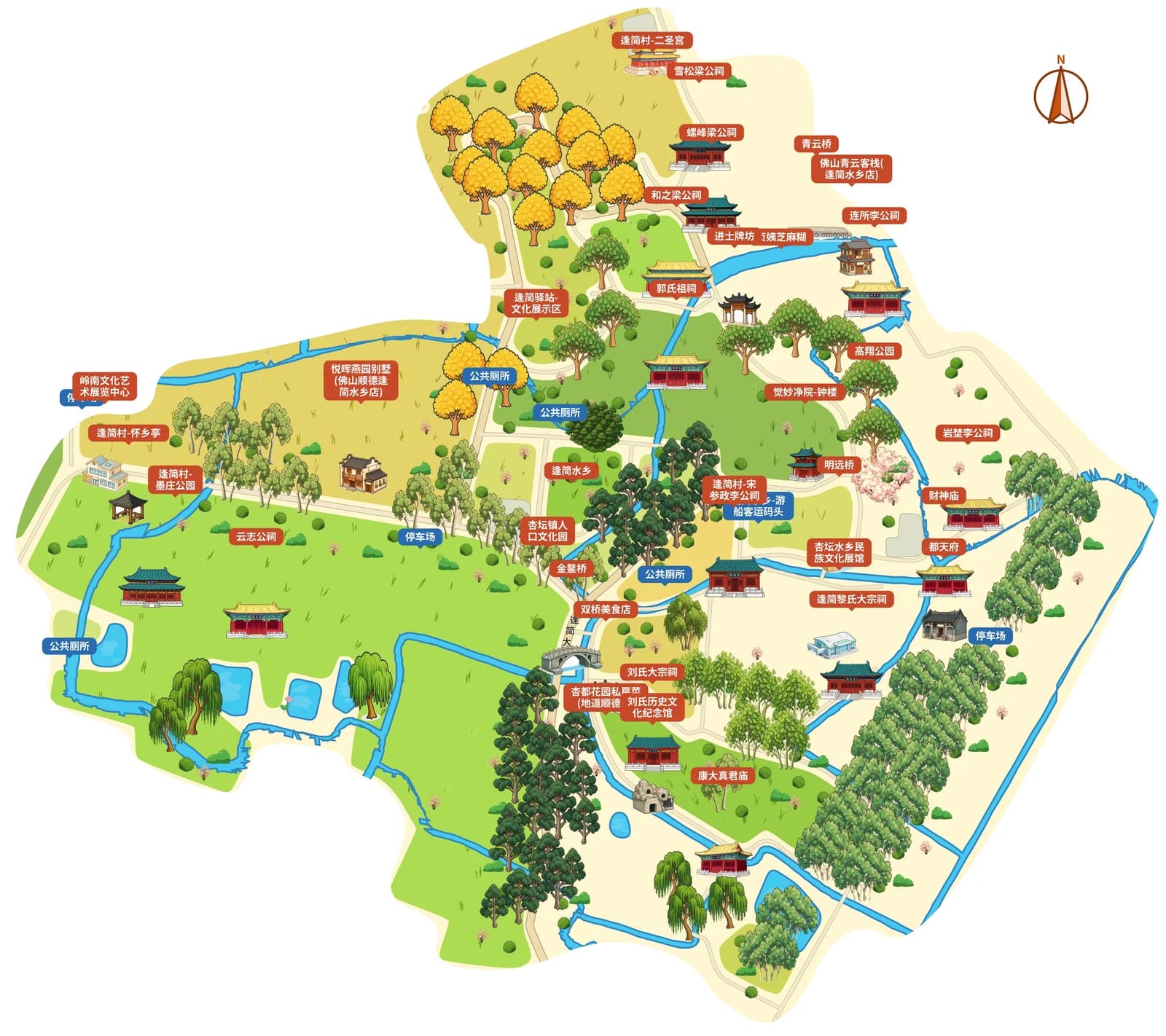
Barns, greenhouses, windmills and animal sheds can use illustrations as recognizable landmarks, but entrances, exits and fences must match the on-site layout. The referenced ancient village maps only demonstrate street lane and landmark presentation; each specific farm needs its own selected areas and source data, and should not copy the building layout of a water village.
Do study tour groups and independent visitors use the same map?
The base map can be reused. The group activity version adds meeting points, lesson order and guide instructions, while the independent visitor version highlights free exploration. Test the readability of numbers and legends on actual printed paper, and have reception staff and farming staff verify visitor flow routes and work zone boundaries respectively before official release.
Frequently asked questions
What content should be marked on an agricultural sightseeing park visitor map?
Prioritize marking open entrances, reception areas, plot numbers, experience zones, restrooms, handwashing stations and rest facilities. Clearly distinguish production vehicle access roads and closed areas; open activities are subject to the farm’s same-day announcements.
Are there editable templates for hand-drawn family farm maps?
You can reference the color scheme and information hierarchy of example cases, then create an editable map based on your own farm’s areas. Example previews are not ready-to-copy farm project templates.
How do you update in-season fruit information on a picking garden map?
Keep plot numbers stable, edit plot names or current-season descriptions, and update entrance notices and reception materials accordingly. Map generation does not automatically pull crop ripeness status or remaining harvest quantity data.
Can farm visitor maps be used for promotional brochures?
You can export files in preset packages for brochure layout. When scaled down, focus on checking plot numbers, service icons and fold lines; activity prices and booking terms must use verified, up-to-date descriptions.
Related map design workflows
- Visitor & Tourist Map Maker
- Outdoor Learning Map Maker | School Visits & Activity Routes
- Old Town & Village Map Maker | Rural Visitor Map Design